Looking Across the Heights
Standing above a Norwegian fjord offers an unmatched encounter with spatial scale. From high crags, ocean water looks like a narrow blue ribbon winding through frozen rock.
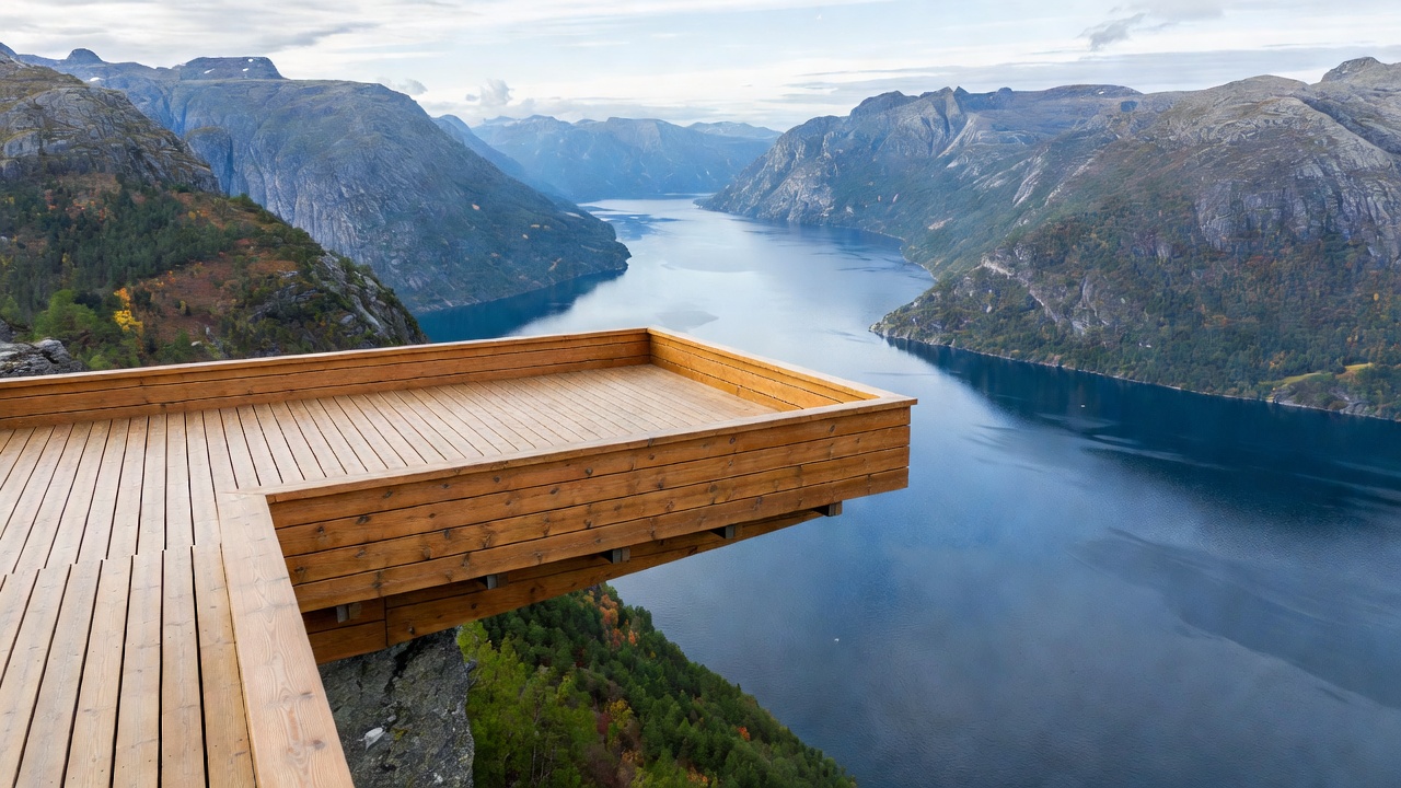
Stegastein: The Cantilever Over Aurlandsfjord
Located along the Aurlandsfjellet National Scenic Route, Stegastein stands 650 metres directly above the calm waters of Aurlandsfjord. Designed by architects Todd Saunders and Tommie Wilhelmsen, the structure is constructed from glued laminated timber and steel. It projects 30 metres out into empty space before looping back on itself, ending in an inclined glass panel that leaves viewers suspended above the precipice.
Because it faces west across the fjord, Stegastein catches warm afternoon light that illuminates the snowy peaks of Bleia and the opposing cliffs of Beitelen, where Aurlandsfjord and Nærøyfjord divide.
Bakkanosi: The Wild Precipice of Nærøyfjord
While Stegastein offers carefully engineered access, Bakkanosi represents untamed backcountry geography. Located near the highland farming community of Jordalen, the trek to Bakkanosi spans roughly 20 kilometres round trip across boggy tundra, scree fields, and rocky plateaus.
The reward at the trail's conclusion is an abrupt, vertical cliff dropping 1,189 metres directly down into the UNESCO-listed Nærøyfjord. Standing on the granite rim, hikers can look down onto passenger boats that appear like tiny specks on the dark water below. There are no handrails or warning barriers here; hikers must contend with fierce updrafts and slippery rock surfaces.
Flydalsjuvet & Dalsnibba: Geiranger Basin
Geirangerfjord offers two complementary vantage points at different elevations:
- Flydalsjuvet (300 m elevation): Situated just above Geiranger village, this stepped rock shelf provides the classic profile view of the fjord entrance, framed by pine trees and sheer chasm drops.
- Dalsnibba (1,500 m elevation): Accessible via the winding Nibbevegen toll road, this summit offers an alpine panorama spanning the Blåbreen glacier and snowfields, leading downward to the Geiranger fjord basin far below. Snow frequently lines this overlook well into July.
Mount Prest: The Panorama Above Aurland
Rising along the ridge directly above Stegastein, the summit of Mount Prest (1,363 m) offers an elevated perspective over the Sognefjord basin without the crowds of roadside lookouts. The trail ascends steeply along a narrow grass ridge that exposes hikers to dizzying views of Aurlandsvangen on one side and Flåm's marine valley on the other.
Viewpoint Elevation and Accessibility Index
| Vantage Point | Elevation | Access Format | Exposure Risk |
|---|---|---|---|
| Stegastein | 650 m | Paved road turnout & wheelchair-accessible ramp | Protected (Engineered glass barrier) |
| Flydalsjuvet | 300 m | Roadside parking & stone barrier walks | Moderate (Unfenced ledge perimeters nearby) |
| Bakkanosi | 1,189 m | 7–8 hour wilderness hike from Jordalen | High (Sheer 1,000 m unprotected cliff edge) |
| Dalsnibba | 1,500 m | Seasonal toll road to high summit platform | Protected (Metal grated skywalk) |
| Mount Prest | 1,363 m | 3–4 hour mountain hike with steep sections | Moderate to High (Narrow ridgeline winds) |